岐阜大学位山演習林_Topographic Index
※事前に林班・路網図の作成を行いmap()の定義をすませておく。
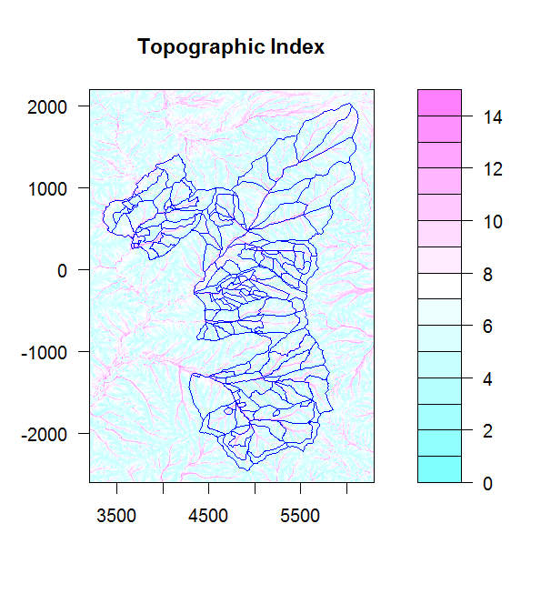
Topographic Index:水の集まりやすい場所で大きな値をとる。McNab W.H.(1992)A topographic index to quantify the effects
of mesoscale landform on site productivity.Canadian Journal of Forest Research:23:1100-1107.
Wouter Buytaert (2009). Topmodel: Implementation of the hydrological model
TOPMODEL in R. R package version 0.6.2. http://CRAN.R-project.org/package=topmodel
##### Topographic Index windows(6.5,7) ###キャンバス load("x-y-topindex.dat") ###データの読み込み ###作図 filled.contour(x,y,topindex, zlim=c(0,15), plot.axes={axis(1);axis(2);map(col2=NA)},main="Topographic Index") |